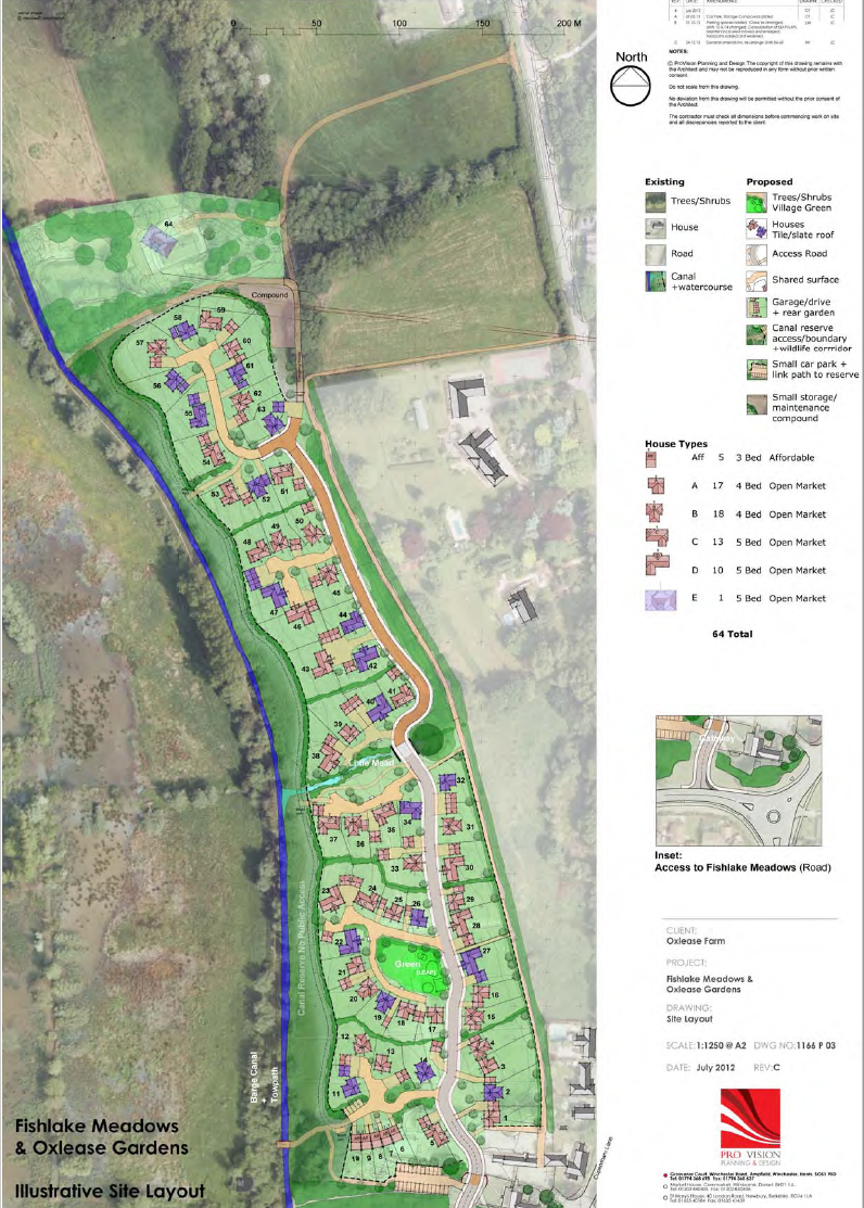
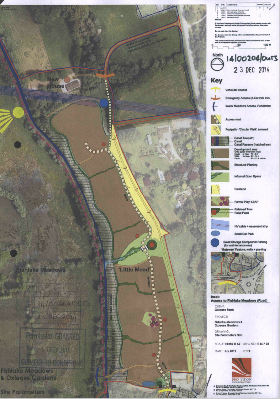
An Oxlease Farm master plan extract is included in the Transport Assessment for TVBC Planning Application 17/02183/OUTs to explain cycle route through the adjoining development. However it is unclear so I've also included another drawing from the Oxlease Farm plan . I copied this from the "AMENDED SITE PARAMETERS PLAN" of 14/00204/OUTS. It shows a 3.7m wide Emergency Access route linking to Cupernham Lane near the top right of the drawing. Cyclists are I think expected to cycle through the "Drive" and "Avenue" to get to the Fishlake Meadows cycle path. It is perhaps a shame that the "Circular Walk" is only to be a footpath. It would be great if future planning applications could include a dedicated cycle network drawing showing just cycle access and proposed connectivity to existing cycle routes, as current plans just have a confusing puzzle of interrelated documents. Perhaps this is something TVBC could help ensure?